Free on iOS
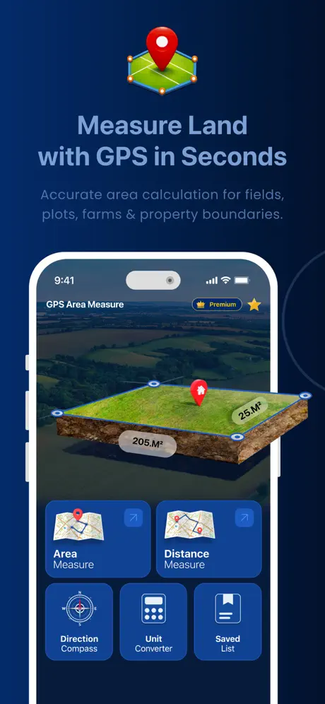
Measure Land with
GPS Precision
Calculate area and distance of any field, plot, or property. Built-in compass, coordinate tools, and professional export formats.
Calculate area and distance of any field, plot, or property. Built-in compass, coordinate tools, and professional export formats.
Powerful GPS measurement tools designed for real-world use. Scroll to explore what GPSArea can do.
Accurate area calculation for fields, plots, farms, and property boundaries. Tap points on the satellite map or walk the perimeter - GPSArea calculates the exact area instantly with 3D terrain visualization.
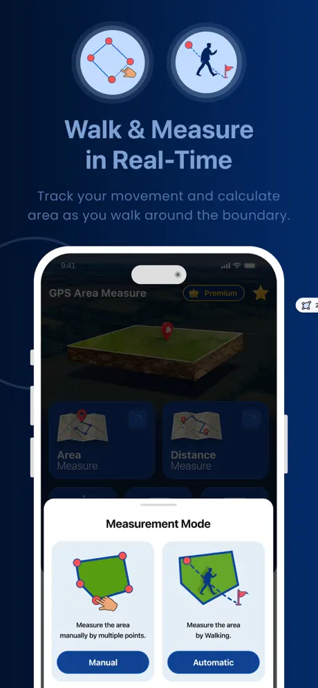
Track your movement and calculate area as you walk around the boundary. Choose Manual mode to tap points precisely, or Automatic mode to let GPS track your path. Perfect for large fields and open land.
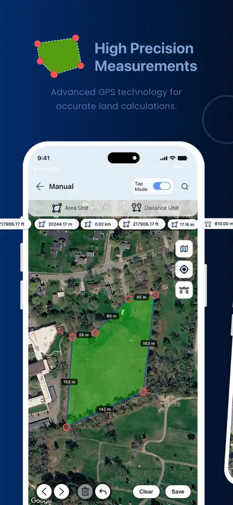
Advanced GPS technology for accurate land calculations. See real-time measurements in multiple units - square meters, square feet, acres, hectares, and more. Each boundary point shows exact distances between markers.
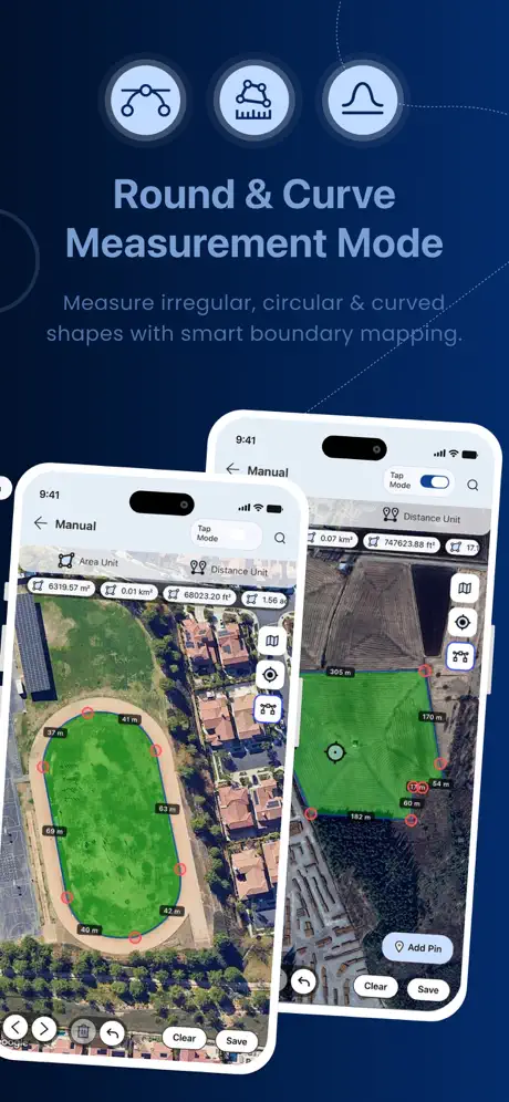
Measure irregular, circular, and curved shapes with smart boundary mapping. Unlike other apps, GPSArea supports bezier curves for accurate measurement of stadiums, ponds, winding roads, and natural terrain.
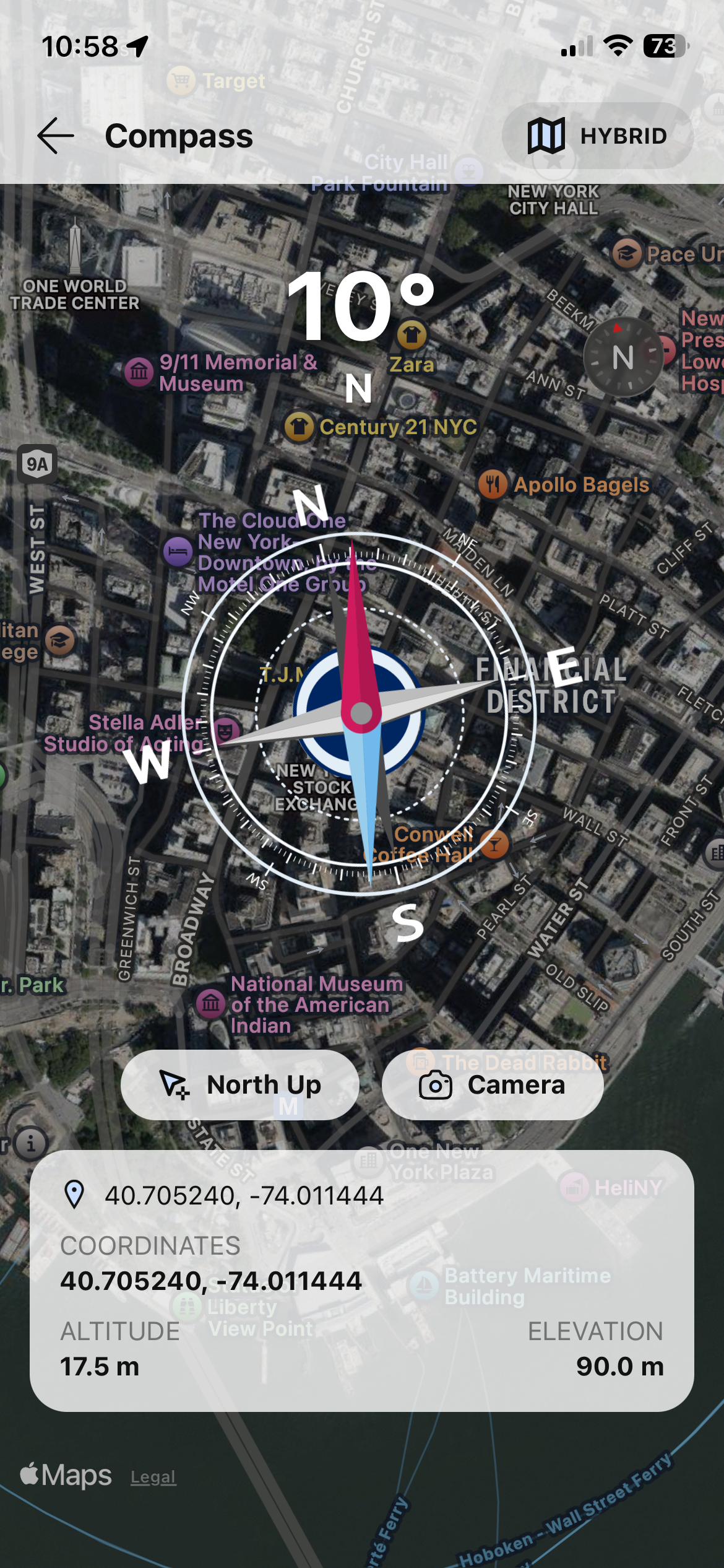
Navigate with a full-featured compass overlaid on satellite maps. See real-time heading in degrees, your exact GPS coordinates, altitude, and elevation. Switch between North Up and Camera AR mode for augmented reality navigation.
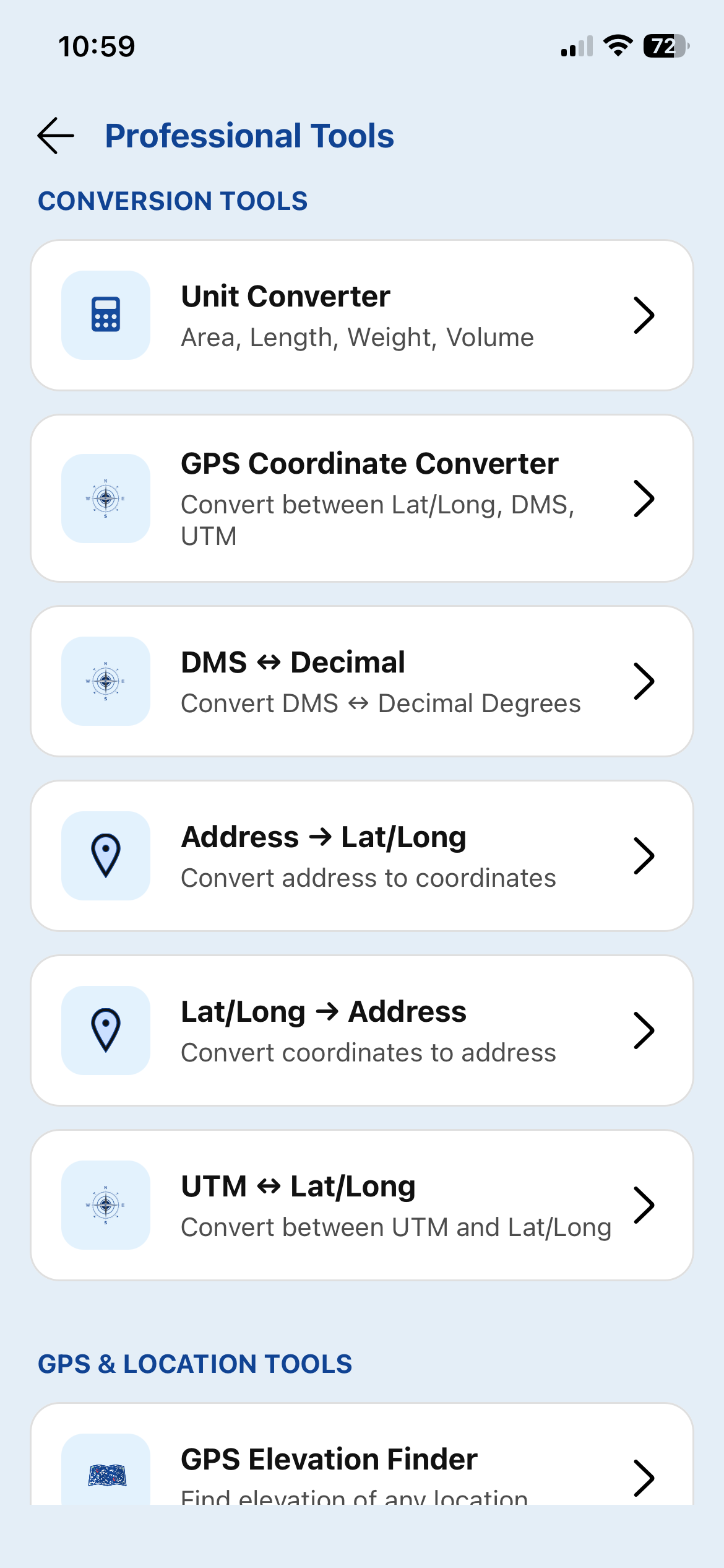
A complete toolkit for GPS professionals. Unit Converter for area, length, weight, and volume. GPS Coordinate Converter between Lat/Long, DMS, and UTM. Address geocoding, reverse geocoding, and elevation finder - all in one app.
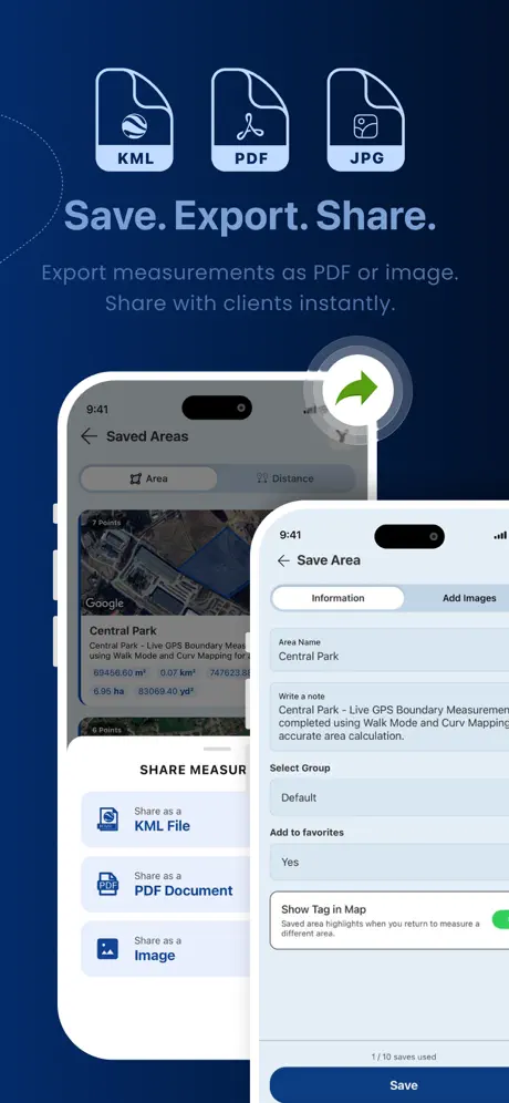
Save measurements with names, notes, and photos. Export as KML for Google Earth, PDF documents for clients, or images for quick sharing. Organize everything into groups and favorites.
Professional-grade GPS measurement tools designed for farmers, surveyors, real estate agents, and outdoor enthusiasts.
Measure the area of any land by walking the perimeter or placing points on the map.
Measure distances between any points. Track routes, paths, and boundaries with GPS accuracy.
Built-in compass with AR camera overlay. Real-time heading and bearing.
View and convert coordinates in decimal degrees, DMS, UTM, MGRS, and plus codes.
Switch between standard, satellite, terrain, and hybrid maps.
Save measurements with names, notes, photos, and groups. All data stored on-device.
Look up the elevation of any location on Earth for terrain analysis.
Convert between area, distance, weight, and volume units worldwide.
A complete toolkit for GPS professionals and land measurement experts.
Convert between coordinate formats
Degrees, minutes, seconds converter
Universal Transverse Mercator
Geocode any address to coordinates
Reverse geocode coordinates
Altitude lookup for any location
Import and view GPX track files
Import and view KML map files
GPSArea speaks your language, no matter where you are.
Download GPSArea for free and measure any land, field, or property with GPS precision.